I was just wondering if other people had any other suggestions for quick ways to create maps? Do you mostly just sketch down a few quick ideas, or plan something more detailed between sessions?
FWIW here’s a Kickstarter that’s about to wrap up that consists of twenty-four 8" x 6* city maps in black and white with no labels. I doubt every single one will be appropriate but they seem the right style and the price point is great. Plus you get the PDF so you can print them larger if you like.
THere’s a neat wargaming community that’s built a deck of cards with good battle terrain. I’m planning on printing out a full deck on nice stock some day: http://perfectcaptain.50megs.com/bfinder.html
Well, it’s a problem. I spent hours searching a lot of sites with medieval or fantasy villages and towns maps, but nothing is right for Plainsworth : there is just no “fantasy town map” which depicts a simple, small town in the plains, without heavy defences or real distinctive figures. It’s always too big, or in the mountains, near the sea, on a peak, with big walls and forts and castles etc. Those sites will generally be much better to provide material for Westlake, Eastlake, Fort Calisco etc. Or for small villages, mountain and forest locations. But nothing for something like Plainsworth !
In the end I just drew my own little map on a A5, just for reference and give some ideas. But I am such a bad artist that I wouldn’t dare showing it, and anyway it’s nothing special.
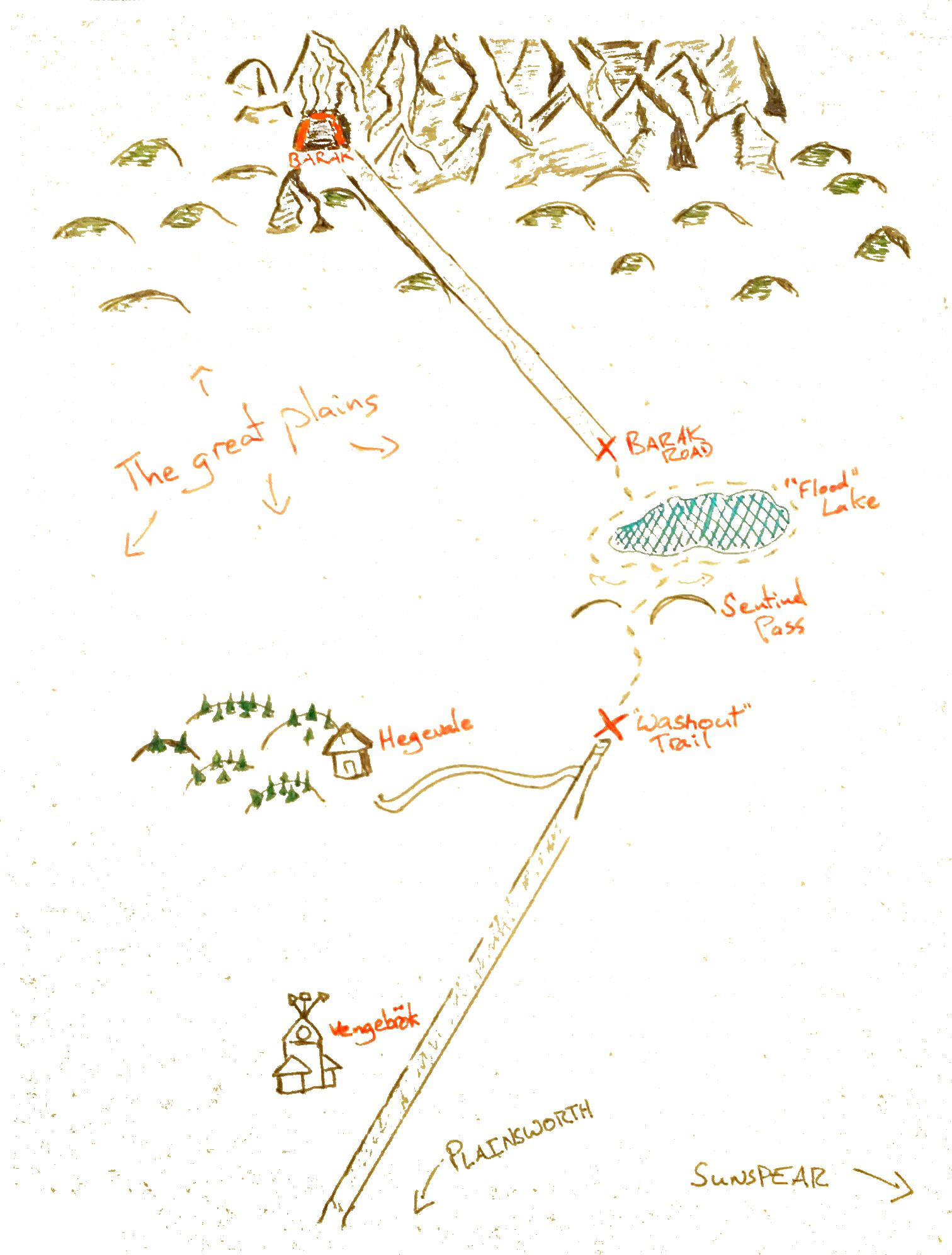
Keep in mind that Plainsworth doesn’t really look like it’s surrounded by plains according to the map. There’s that sizable mountain range to the west that seems to hug it.
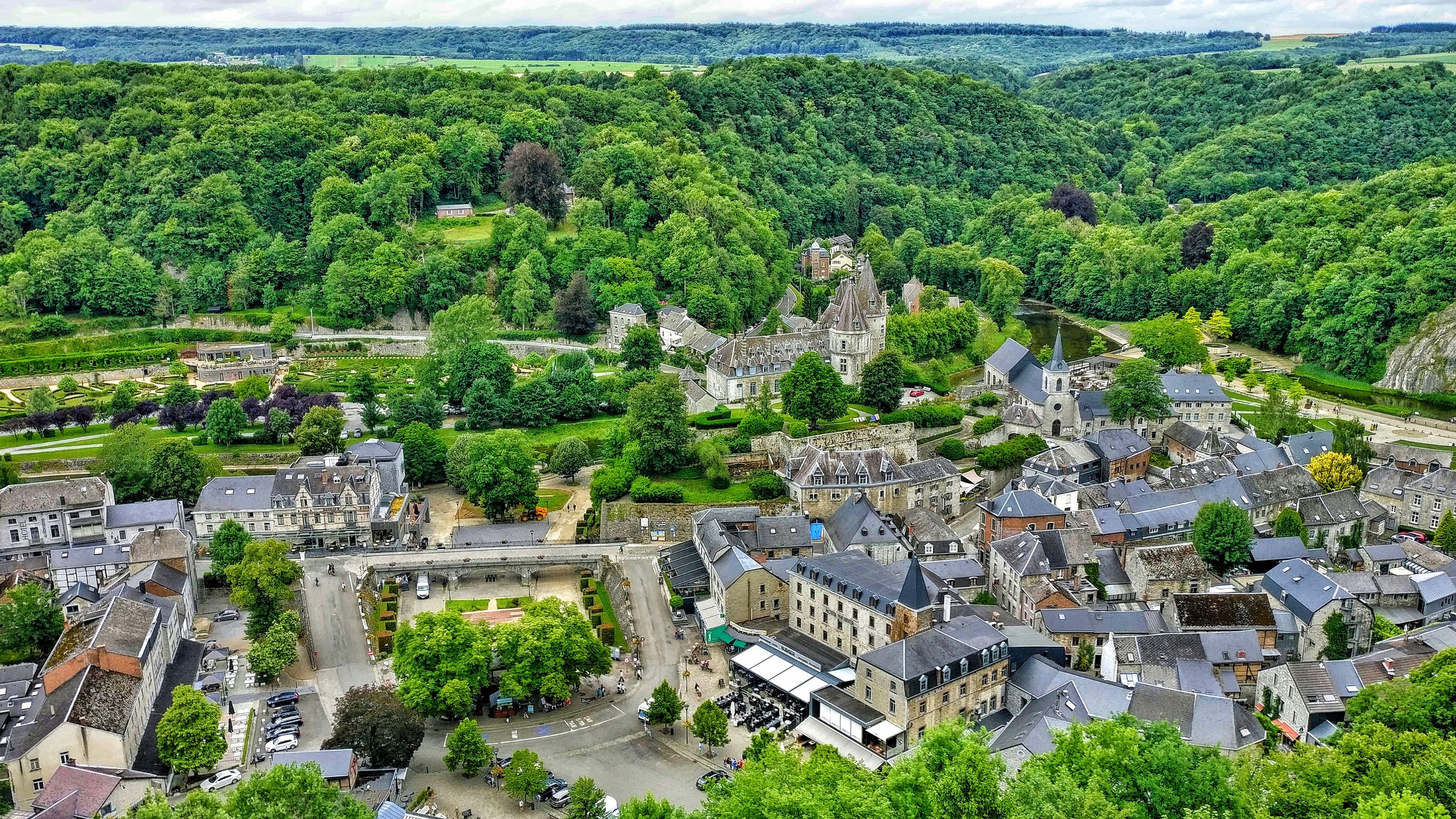
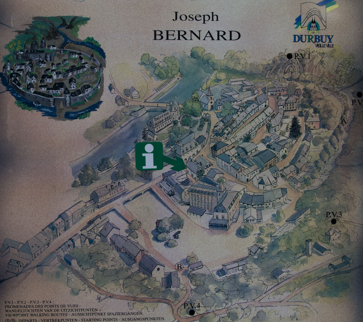
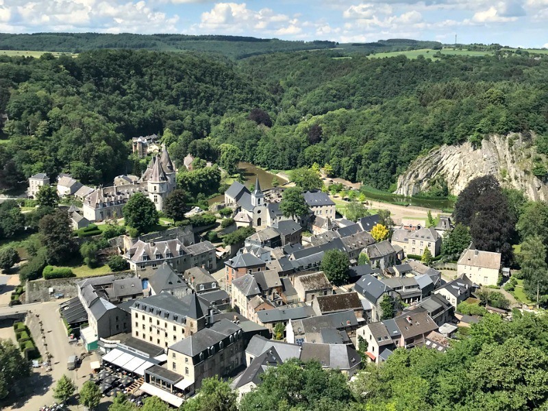
I found a city called Durbuy in Belgium that seems like a good fit. Didn’t have much luck turning it into a black and white printable handout, but here’s some photos I found using Image search.
An interesting point. But, what’s the scale of the general map ? To me, the moutains lie at least a few dozen kilos east of Plainsworth, the Taigeria a few dozen kils to the west.
Also, the name ot the town itself says it’s in the plains. And, moreover, you have this on page 379 in the description of it: “Situated in the heart of the Aldermark breadbasket,…”
I agree Durbuy is a nice little town, maybe not “medieval” enough for my vision of Plainsworth!
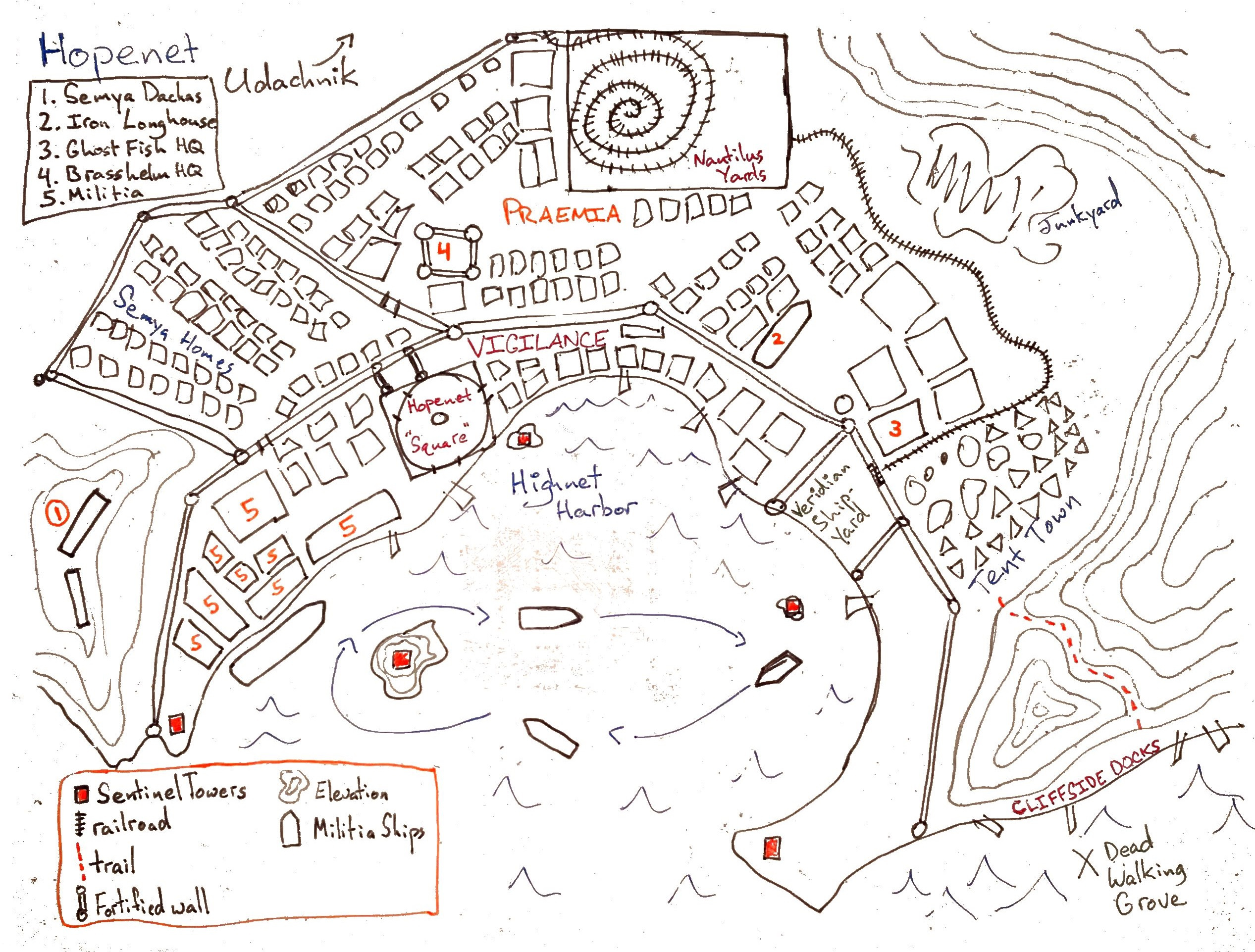
Thought I’d put up some of the maps I’ve used. I’m a dinosaur who still does everything on paper, but I do use a Rocketbook these days to make digitizing the images easier.
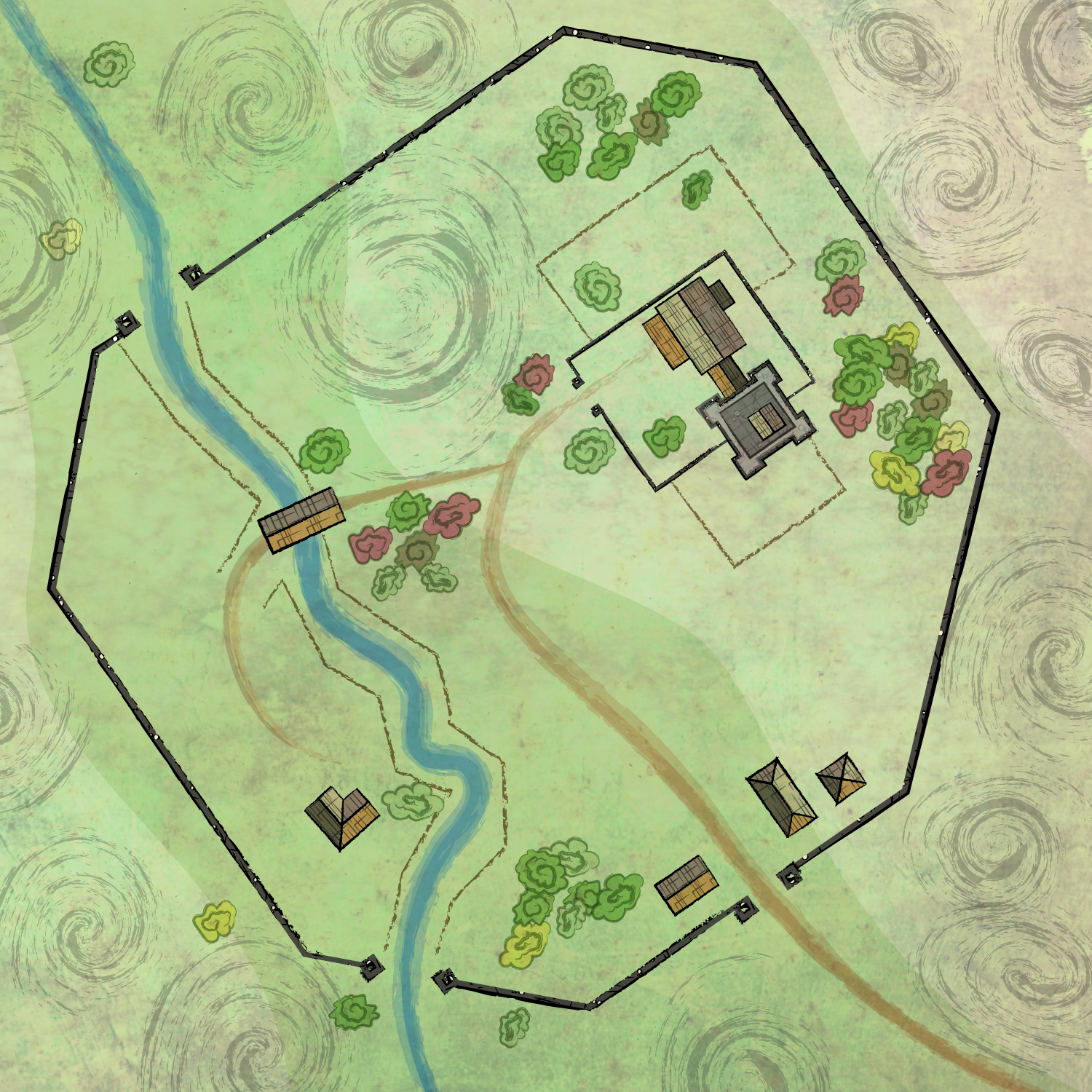
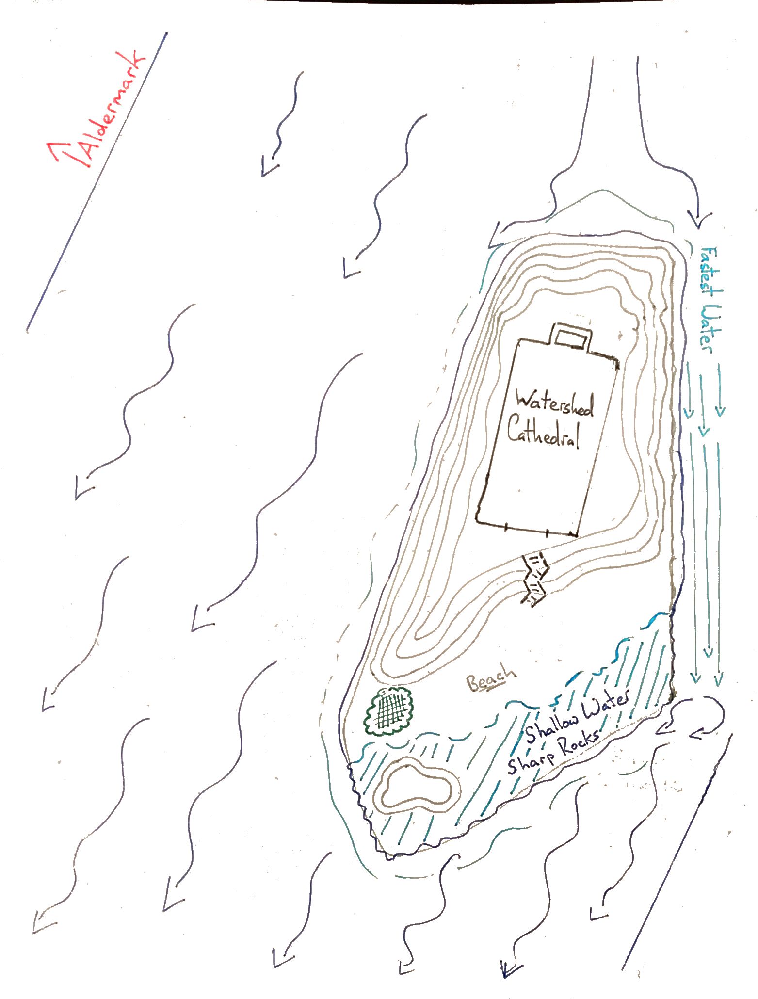
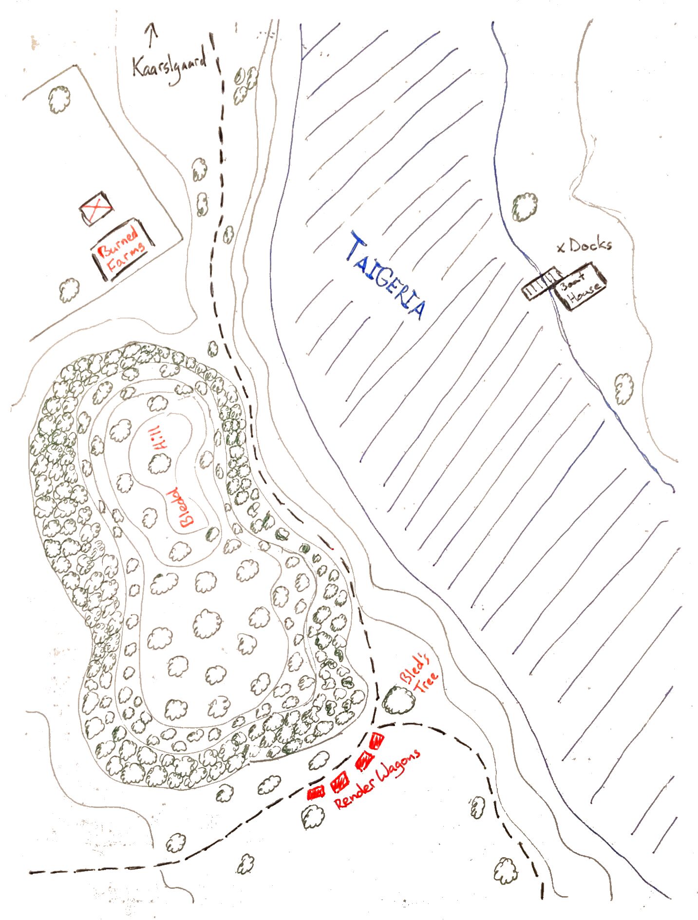
The first map for the Watershed Cathedral special mission. As the Cathedral is on an island located in the Taigeria I thought it would be fun to have some kind of nautical obstacle: "Will the Legion survive the treacherous waters of the Taigeria?!?
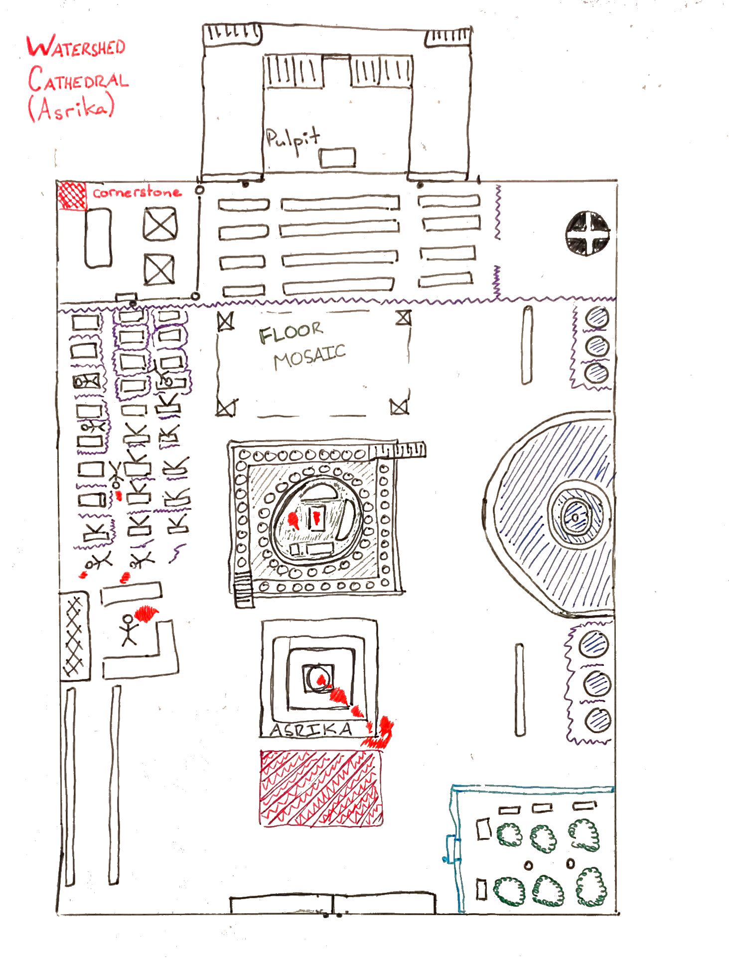
Internal map of the Watershed Cathedral. In the center of the room is a raised operating theatre. A large fountain of miraculously sterile and pure water runs on the east wing. The west wing contains hospital beds. There is a valuable garden of medicinal herbs in theh southeast.
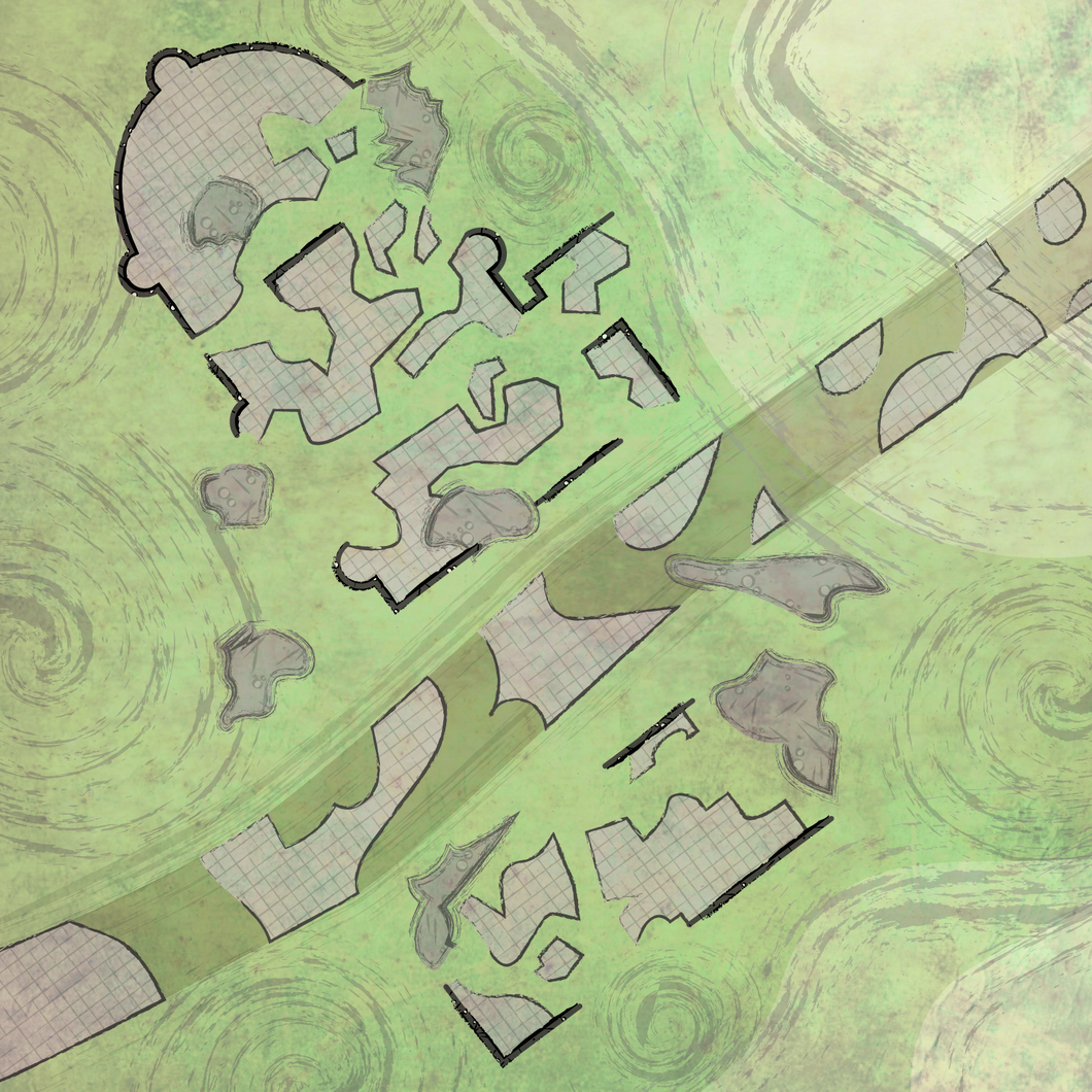
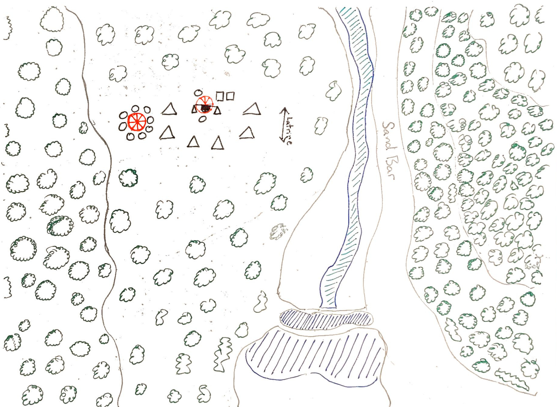
A closer view of the Long Road for a mission where the Legion set up and (successfully!) ambushed Render’s Lieutenant The Sable Arrow. Only took 2 deaths, 2 rank 3 harms, and a stressed out Heavy.
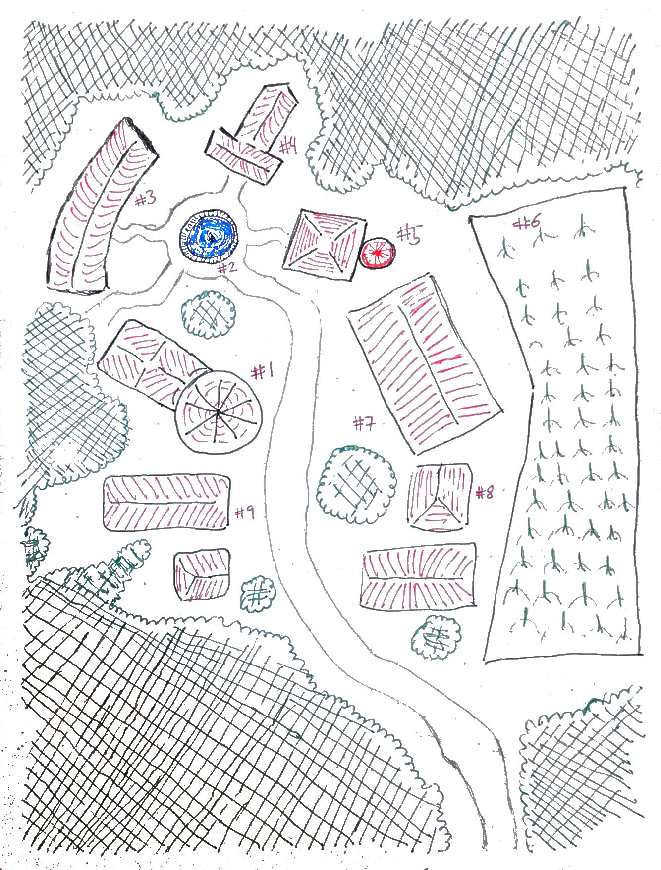
The set of geomorphs is a bit limited, but if you want something quick and dirty, this page generates Settlement Maps for cities, keeps, and villages. https://wizardawn.and-mag.com/tool_villg.php
I’d probably screencap it and refine it a bit in photoshop but it’s a nice jumping-off point.
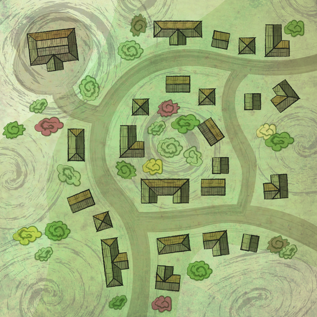
A small community in the Talgon Forest, where an important courier hides in the basement of the local church. The rest of the town is in the process of being converted into Hexed and Burned by Breaker’s forces. When the Legion fights here in the mission I used fog of war effects, which I normally don’t because Breaker’s forces are now literally wreathed in fog thanks to my power choices.